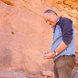
When we got there we knew it was special. We could see stone tool types from several time periods and several different areas of exposed paleolake deposit.
Dr Paul Breeze
01 September 2021
New research reveals how repeated climate change allowed early humans to move into the Arabian Peninsula
Satellite mapping analyses have located ancient lake deposits with archaeology, which show how dramatic climate change repeatedly allowed past humans, including our own species, to move into the deserts of Arabia.
A new discovery, published today in the journal Nature, and including the oldest dated hominin occupations in Arabia, reveals at least five hominin expansions into the region coinciding with brief ‘green’ windows of reduced aridity at approximately 400, 300, 200, 130-75, and 55 thousand years ago.
Dr Paul Breeze and Professor Nick Drake of King’s Department of Geography developed the methods to locate ancient lakes and rivers across Arabia as part of a large international and multidisciplinary project.
The Green Arabia project is run out of the Max Planck institute for the Science of Human History, and headed by Professor Michael Petraglia. The satellite mapping techniques allow the project team to identify targets for archaeological survey and excavation. This led the team to a hollow between 90m tall sand dunes in northern Arabia, called Khall Amayshan 4, holding an unprecedented record of how prehistoric humans were able to move into ‘Green Arabia’ repeatedly over the last 400,000 years.
Dr Breeze coordinated navigation to and mapping of the site on the ground. “One of the things we need to do to understand a site like this is to see how everything relates to each other, so we walked for tens of kilometres across the desert with a highly precise GPS, recording the height and location of everything we see so that we can build a detailed map of the landscape. When we did this it was clear there were 6 ancient lake beds here, at different heights, each with different archaeology concentrated on them. When the lake sediments were dated it confirmed that these were all from different wet episodes in Arabia’s past.”
The changing distribution of lakes and water in this area underlines what a dynamic location this was for human occupation and dispersal. Furthermore, by mapping water sources we can not only locate these new archaeological sites but also pin down the routes these people took to get there.
Professor Nick Drake
Dr Paul Breeze described more about the method used to make the discoveries. “We use elevation data to determine where rivers flowed in the recent past, while radar images reveal older buried channels. Our method then detects lake deposits using statistical methods to classify multispectral satellite images, to isolate the mineralogical fingerprint of ancient lake deposits across vast areas. This leads us to target areas where we use more detailed satellite data to find even more deposits. Across Arabia we have identified thousands of sites where lakes formed in the past, and have visited many over the last decade, some of which are revolutionising our understanding of the prehistory and past climate, including finds such as the earliest Homo sapien fossil and footprints.
This latest paper, led by Dr Huw Groucutt of the Max Planck Institute, demonstrates in a single site how each time Arabia was wet hominins moved in and how the material culture those humans were bringing with them changed over time. In some cases this reflects the presence of different species, while in others, it may indicate different regional origins for the populations which reached northern Arabia.


